Welcome back – are you all buckled in and ready for a trail day?
Boy we sure are – we are topped off with our water – plenty of fuel and excited for the trails we have read about and cannot wait to see the northern remote part of the park.

We are starting off driving past Ubehebe Crater, and instead of taking a left – to visit this massive crater, we are taking the dirt road north titled Big Pine/Death Valley road. This is a graded dirt road that if you so desire will skirt you up into Big Pine, California, off HWY 395.
There is only one other car on the road as we start our day trip. We skirt high desert and lovely views abound crossing this section of the trail. Stopping at Crankshaft Junction – which is littered with old crankshafts, as this route is remote and vehicles in the past were known for breaking down in this remote area. The Junction pays homage to those who have not faired as well taking the road less travelled north through the unforgiving desert.
At this point, there is an option to meander up into Last Chance Mountain, we are not taking that offer and staying the course, continuing on Big Pine Road, northwest. We pass by a Mines and meet the Eureka Dunes Dry Camp turnoff. Real subtle like, we turn left and are heading south towards Eureka Dunes. This is one of the least visited areas of the park and it is truly a sight to see. I simply had no idea, the beauty ( I mean sand dunes, they can’t be THAT great can they?). These dunes can, as they tower at more than 680 feet above a dry lake bed, which lies in the remote Eureka Valley at a 3000 foot elevation. The dunes are 1 mile wide and 3 miles long, which doesn’t seem impressive, like I was all (oh they are cute so only a few miles, baby dunes), but they are massive in height and as the wind shifts, it reminds you of scenes in epic movies with white glistening dunes, waves of sand dancing in the breeze.

Our trail begin’s here? Oh goodness.
It finally sinks in, we really are off the regular map aren’t we?
Yes, yes we are, and it is exhilarating and honestly a little terrifying (me, not Kyle, he is loving this, like perm-a grin on his face, he is in his element).
We follow the trail around the back of Eureka Dunes (you are not allowed to drive on the dunes, up the dunes or any shenanigans like that; you wouldn’t want to, the pure incline of the dune is such you wouldn’t get far). We begin the climb up the side of the valley basin, towards Dedeckera Canyon. Good thing Kyle is navigating, because all roads look like a trail to me, I would get us L O S T in 3.2 seconds, I swear.
Wind is blustering and we are just grinning from ear to ear, as we travel along the trail. Out of the dunes and up into the canyon the landscape completely changing. We are soon rounding on our first obstacles – rock waterfalls. Normally the trail is run south to north, but with our new plan, that is not how this train is a rolling – so we are charging up these rock waterfalls (Eeeeeee! This is our first ever real off-road challenge with our our Sleeping Beauty Jeep, please house don’t break- fingers crossed, because we are doing this).
Now if you don’t off-road or vehicle rock climb, there is a spotter (hi, my name is Mrs. McCoy and I will be your spotter for this portion of trail) and there is a driver (please let me introduce Mr. McCoy, he will be the expert driver for this part of your journey). I step out into the whipping wind and with Kyle’s window down, we begin to line up our plan of ascent. It is a little tight and the rock waterfalls have ledges that our Jeep will have to scurry up, they are big and jagged, Kyle had slipped into 4Low and here we go!!!
Here are the photos, I tried to video it, but being a spotter; saying wheels driver, then passenger – that is instead of left or right to help the driver place their tires in the correct area to ensue proper grip on the trail (I learned from YouTube, felt very professional) I kept moving the recording hand in the same direction I was saying to put the tires – Hilarious, epic documentation fail – but the half video we have, we are proud of anyway.


Bump, engine roar, tires engage, more engine roar, squeak, crunch of gravel, pop up of the front part of the Jeep, oh my we are doing this! More jumping, more engine roars and hop hop, jump, roar, we are up! Oh my. Kyle stops, I run up to the drivers door and say how was that because it looked so cool (like Fonz cool – sew-per cool). Eyes sparkling, smirk plastered on his lips, words were, that was awesome – we need more of that in our life. Oh the bug has bit. I climb back into the passenger seat and we are shaking up the trail, weaving through rocks, curving with the terrain and following the slow incline over the mountains. Once we reach the top, we find a small turn out and make lunch, here is our view. Not too shabby for a lunch break, eh?

From here we will be navigating our way down the mountains, through some additional valleys and come into Saline Valley Warm Springs, where the Park Ranger said, is a good place to camp, BUT warned people like to soak in their birthday suits. Nakie people, people. We get into Saline Warm Springs, and it is windy, gusts and blowing, tents are flapping, palm trees (think traditional cartoon oasis, it is what it looks like) swaying, blue pools beckoning. Quick scope of the area, Kyle has identified 3 naked people all in one pool and there is one pool open, no one is there.
The question is out in the air.
Kyle: Are we stopping?
Me: Is there water?
Kyle: Yes
Me: Park and let’s get in that water!
Kyle: Bathing Suits, right?
Me: Yup, we got to change fast before that open pool loses what little shade it has.
We are parked, towels out, changing in our suits and flops, padding our way to the open pool. It was warm (not too hot, not too cold, I am saying Goldilocks approved).

Me: Ahhhhhhhh
Kyle: Not too bad
Me: Ahhhhhhhhh
10 minutes later (I have my glasses off, I am blind, the world is fuzzy).
Kyle: Uhm, we are going to have to get out, now.
Me: Why? It is so nice, we just got in.
Kyle: Dust Storm, Haboob style, rolling right at us.
One….Two….Three…. We are slammed with sand, flip flops try to run for cover without us, dripping wet and trying to use the wind to help us wrap our towels around our bodies, we scurry back to our Jeep for cover.
Kyle gets his shirt on, I get my sundress and we fire up the Jeep. Bye Saline Warm Springs, our 10 minutes of bliss was wonderful.

We now take the road out of Warm Springs to junction with the Saline Road, which looked on our map to be a paved road that travels north and south around this portion towards Big Pine. The wind is so strong that we can barely make out the road to follow. Please see picture below. Now imagine, wind howling and gusts rocking you as you drive, who needs carnival rides when Mother Nature decides to throw a wind party?
We make it to the junction, wait, what? Where is the paved road? Nope, it is a non-improved road (meaning dirt, rutted and rough) for the next 36 miles.
You hear stories of people who have broken down in Death Valley, had to roll into a town or the park with help from others, and I naively thought, not these days, all of our cars have such great gas mileage people make it out just fine. Right?
Well, nope. Driving along the Saline Road, BAM right there smack dab in the middle of it, is a Toyota 4Runner, their A-Arm (the bar that goes from the frame to the wheel hub, if you didn’t know, like me, all I saw was a wheel all popped out funky and an empty SUV) dead. We pull up slowly, to see if anyone in inside, it was empty, so whomever the owner was had secured help. Somehow, because there was no cell service, and no one else anywhere on any-road that we had seen for over 2 hours. Regular maintenance and service on your vehicles, it matters.
The sun is lowering in the sky and we reach pavement, I have never been so happy in my life – emerging from the dust storms, with 50 miles of fuel left in the tank, we will make it to Lone Pine. Whew.

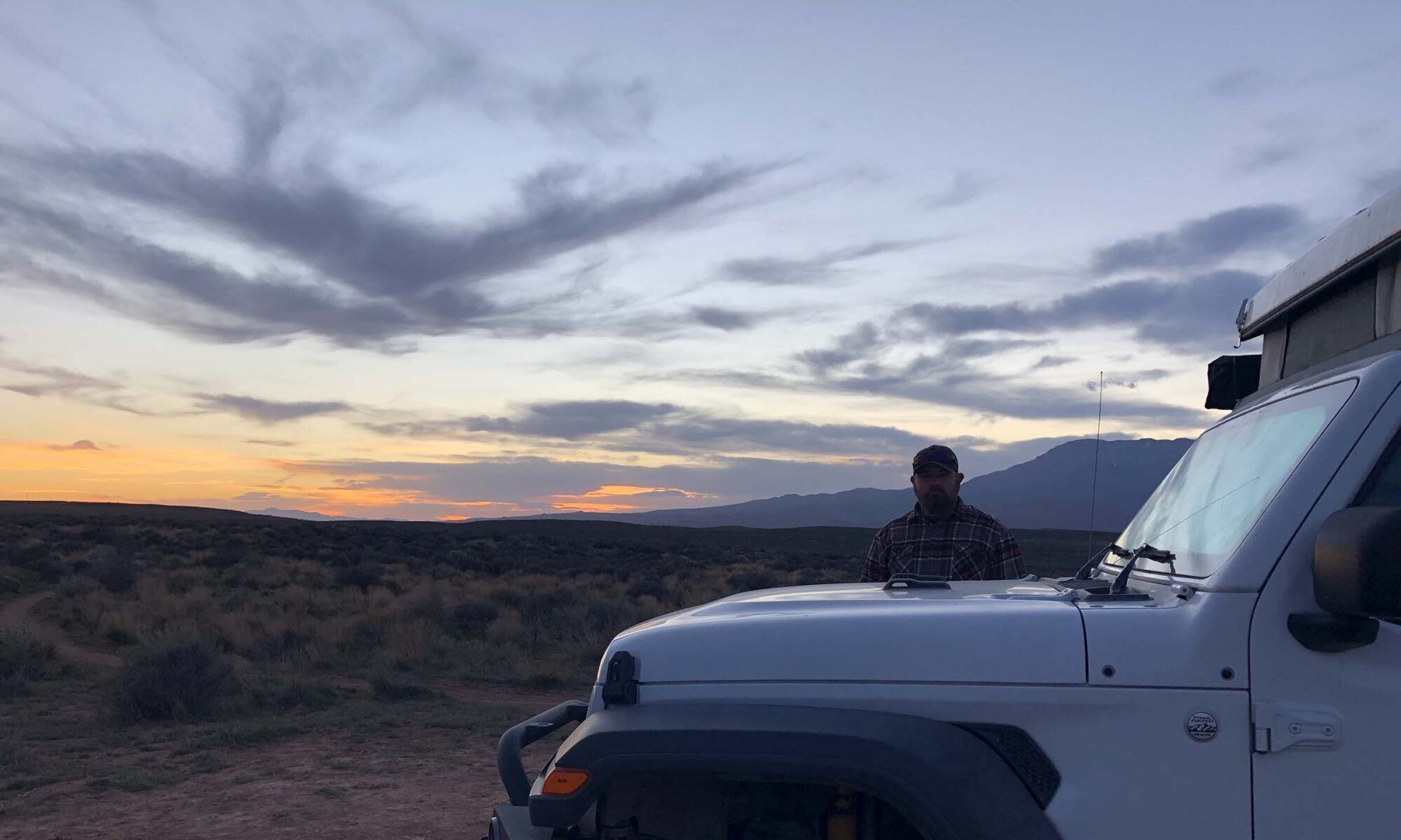
Chevron, we salute you and your chosen location for fueling on the outskirts of Lone Pine. With cell service and fuel, we find a wild camp in the Alabama Hills for the night, trying to find some sort of relief from the wind. Camp is set-up, dinner is made (gourmet PB&J anyone)? Snuggling into our Ursa Minor Tent for a little book reading and much needed rest, we close our eyes to the rustle of our tent walls in the wind. Grateful for emerging, triumphant for the capabilities of our Jeep and exhausted from the long day on all of the roads and completely blissful in the adventures our new life is bringing us.


In the morning we will figure out what we do next, because it seems that nature has a different trip itinerary that what was originally thought.
Talk next week, where we follow California Highway 395, North.